Case Studies
Upper Township
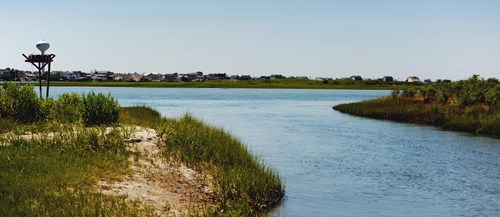
Located in northern Cape May County, Upper Township is one of New Jersey’s original 104 townships, having been incorporated to the state in 1723. The township is made up of many smaller villages on the mainland of Cape May County as well as Strathmere on Ludlam Island. Approximately fifty percent of the Township is in the floodplain as its borders include the Tuckahoe River, Great Egg Harbor Bay, Peck Bay, Crook Horn Creek, the Atlantic Ocean, and Ludlam Bay. Upper Township has been working toward resilience for years. The “Upper Township Getting to Resilience Recommendations Report”, along with the community’s current work with JC NERR and partners at Rutgers, Monmouth University, and The Nature Conservancy, will continue to build a strong resilience foundation for the future.
Upper Township Recommendations Report
Upper Township Recommendations Report - Appendix
Borough of Atlantic Highlands
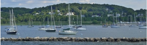
Atlantic Highlands is home to the highest headland on the east coast of the United States south of Maine. Elevations in the Borough range from well above 250 feet to sea level. The dramatic changes in elevation lead to a variety of hazards such as landslide potential, precipitation based creek flooding, and sea level and storm surge related flooding. Equipped with a Recommendations Report to increase resiliency in the community, Atlantic Highlands is now working with the Jacques Cousteau Reserve and partners at Rutgers and Monmouth University to implement many recommendations.
Atlantic Highlands Recommendation Report
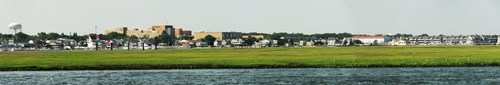
City of Perth Amboy

Perth Amboy's strategic position at the intersection of the Raritan River and Arthur Kill at the opening of Raritan Bay has allowed the city to grow and flourish during its rich 300 year history. However, this exposure has also put the economically important waterfront at risk to flooding and storm damage. Perth Amboy's urban development also creates occasional precipitation flooding problems. Now in a period of active revitalization and redevelopment in several neighborhoods, JC NERR staff was brought in to facilitate the Getting to Resilience process to better inform decision making and planning for the future.
Perth Amboy Recommendations Report
Township of Toms River
The Township of Toms River includes a diverse group of communities located along the oceanfront, Barnegat Bay, the Toms River, and various streams and wetlands. Toms River is the County Seat of Ocean County and connects Barnegat Bay Island communities to the mainland via the Thomas A Mathis Bridge. Toms River was among the most heavily impacted municipalities by Superstorm Sandy. JC NERR staff was brought in to facilitate the Getting to Resilience process as part of the NJ Department of Environmental Protection's Municipal Public Access Planning program.
Toms River Recommendations Report
Borough of South Toms River

South Toms River is a small borough resting on the banks of the Toms River. Largely residential, the community is vulnerable to flooding near the river and its tributaries. A risk to forest fire also exists away from the river where the town reaches extensive pine oak forest. After experiencing flooding during Superstorm Sandy and working with Ocean County on hazard mitigation planning, JC NERR staff led South Toms River through the Getting to Resilience process to learn about vulnerabilities to hazards in order to inform future municipal plan updates.
South Toms River Recommendations Report
City of Somers Point
Surrounded by water on three sides, Somers Point has had a strong maritime connection since the city was founded. This connection continues to influence the culture and economy of the City. The City’s location on Great Egg Harbor Bay and Patcong Creek means vulnerability to coastal hazards. From 2007 to 2012, Somers Point experienced eight natural hazard events, including Superstorm Sandy, which has led to federal disaster declarations. JC NERR staff was brought in to facilitate the Getting to Resilience process after Somers Point had completed their Strategic Recovery Planning Report and before the City had completed the Somers Point Master Plan Reexamination.
Somers Point Recommendations Report
Maurice River Township

Maurice River Township is located along the Maurice River in Cumberland County. A large portion of the Township’s economic stimulator, including fishing and shellfish industries, are along the Maurice River. Like much of Cumberland County’s Bayshore, these areas are vulnerable to coastal hazards.
Maurice River Township has been working with a Local Recovery Planning Manager provided by New Jersey Future to develop and implement effective long term recovery and resilience strategies. JC NERR staff was brought in to facilitate the Getting to Resilience process as a lead into the deeper vulnerability assessment that NJ Future will be completing.