Using the Mapping Tools to Understand your Current and Future Risk
In order to answer the evaluation questions posed by the Getting to Resilience, a community will need to assess their current and future flooding risks and hazards.
The Risk and Vulnerability Assessment Checklist is a facilitation tool to help communities identify who should be involved in the resilience discussion, what topics should be considered, and what assets should be focused on.
New Jersey Specific Mapping Tools
NJADAPT (www.NJAdapt.org) is a New Jersey-based website that provides communities with the ability to develop municipal profiles of various risks that may potentially impact their areas by making climate projection data for NJ more accessible.
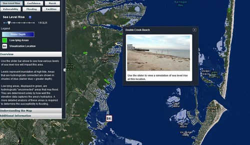
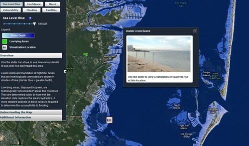
Through NJADAPT you can access the NJFloodMapper.org.
The NJFloodMapper is sea level rise and flood mapping website that visualizes different inundation scenarios and overlays additional data layers including critical facilities, evacuation routes, FEMA flood maps, storm surge models and the extent of inundation from Superstorm Sandy. The site is further enhanced with on-the-ground photo visualizations of inundation impacts at iconic Jersey Shore locations.
The Risk and Vulnerability Assessment Checklist is a facilitation tool to help communities identify who should be involved in the resilience discussion, what topics should be considered, and what assets should be focused on.